Shortcuts
Hiking
Káraborg - Klambrar
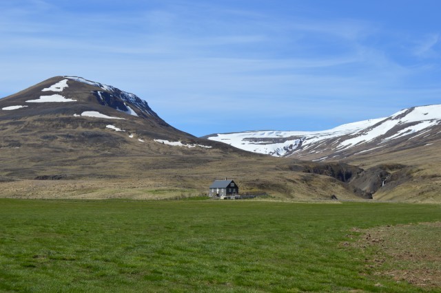
On Klambrar one can find a renovated stone house from 1880-1885, which is conserved and in the icelandic register of antiquities. The local doctor lived there and hosted a apothecary and a hospital. The name of the stonesmith is unknown, but this type of stone houses is extremely rare in rural Iceland.
Read more
Langafit in Laugarbakki
The hike starts in front of the community centre Ásbyrgi in Laugarbakki. There is a trail that leads down towards the Miðfjarðará river. The trail goes through high wild fauna towards the river bank where one will turn southward and follow the river. Bird life is diverse along the path in the summertime. This is where the historical horse competition in the sory of Grettir the strong happened. The area is called Langafit and the story tells that the audience sat in the hillside but the competition itself happened on the plateau below.
Read more
Lombervegur (Ombreroad)
The road was made in the beginning of the 20th century, to connect the farms Aðalból in Austurárdalur and Efri Núpur in Núpsdalur, to allow the farmers to easily meet up and play the card game Lomber (Known as Ombre in English) with each other. Lomber is a card game originating from southern europe and the tradition of playing Lomber still lives in Húnaþing vestra.
Read more
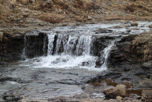
Selárgil
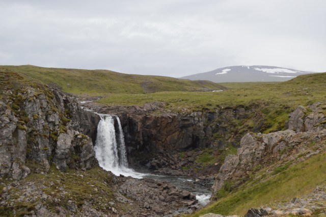
The Selárgil canyon is magnificient with several beautiful waterfalls. Some of the waterfalls are only visible from one side though, so the most enjoyable hike is to walk up the canyon on one side and back from the other side. It is recommended to bring appropriate footware for crossing rivers.
Read more
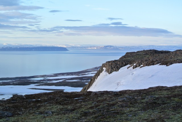
Ánastaðastapi - Grímsá
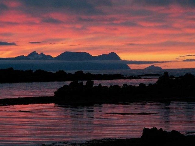
Ánastaðastapi is a sharp rock by the sea north of the farm Ánastaðir. By Hvalshöfði is a small creek between the rock and the farm where 32 large whales stranded because of the arctic ice on the icy spring of 1882. They were killed and cut on the beach. It is said that this whale stranding saved loads of people from starvation that year, but people traveled long distances to get some meat. Ice pits were made on the beach to store the whale meat so it could be eaten later that year.
Read more
Þrælsfell
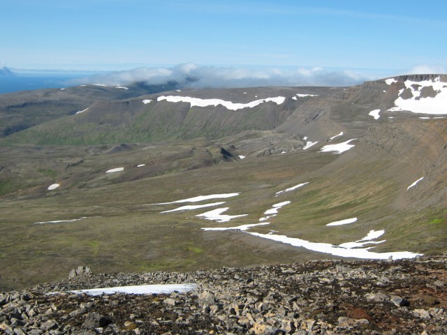
Þrælsfell is a 895 meter high mountain top and is therefor the highest point of Vatnsnesfjall mountain.
Read more
Hvammstangi - Kirkjuhvammur
In Hvammstangi is a marked hiking path which starts next to the Kaupfélag grocery store. The path starts north of the bridge between the Kaupfélag grocery store and Hlaðan café but there you can find the hiking sign. One should follow the riverbed on a gravel path upwards until you reach a small foot bridge. It is worth going over the bridge, sit down at a nearby bench, and enjoy the area. After that you'll continue following the river south of the Hvammstangi church. Shortly after the church you will get a nice view over the town. The path then continues along the river until you reach the camping ground.
Read more
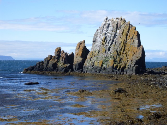
Hvammstangi - Káraborg
Káraborg is a series of rocks and cliffs standing over the town north of Hvammstangi. From there is a rich view during good weather.
Read more
Illugastaðir
Road 711. Illugastaðir is a historic farm where farmer and herbalist Natan Ketilsson was murdered in the year 1828 and that lead to the last execution in Iceland 1830. Recent book by the australian author Hannah Kent, Burial Rites follows the story of the alleged murderes Agnes and Friðrik and their execution at Þrístapi in Austur Húnavatnssýsla for the murders. The ruins of Natan's workshop is still visible on a reef named Smiðjusker. Illugastaðir has a beautiful view over to Strandir on the Westfjords.
Read more
Grund - Hvammstangi
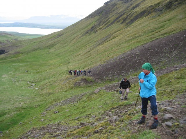
Road 711. Start hike from the farm Grund in Vesturhóp. There you'll see a waterfall named Foss and shortly after a path leading up Heydalur valley. There's some slight sudden elevation change but apart from that an easy path. When you reach Þröskuldur the hike will lead you through a highland landscape with a marked path to Ytri Hvammsá river which flows north of Hvammstangi. The hike ends at the Hvammstangi camping area in Hvammur.
Read more
Gauksmýri pond
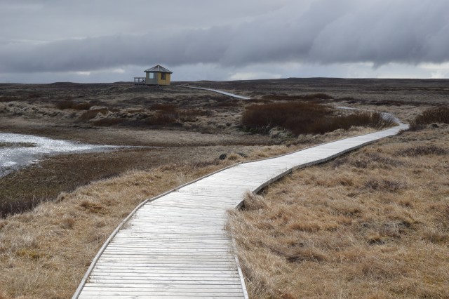
500 meter long path which fits every one. The Gauksmýri pond is a recovered wetland where 45 bird species nest. Including the fascinating horned grebe. Bird watching house with information about birds and binoculars can be found at the end of the path.
Read more
Brandagil - Húkur
Jeep-, horse riding-, and hiking route. Perfect for cyclists to circumvent the main road. Great view and peaceful road.
It is said that nowhere in Europe is it as easy to see the common loon (Gavia Immer) as he travels all the way from America to lay eggs in the area. Do note that only a single couple of common loons settles on each lake.
Read more
Miðfjörður River Delta
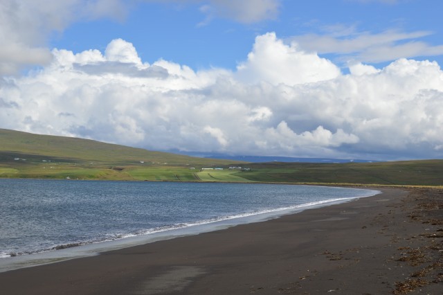
South of the farm Sandar lies a track from road 72 to the east. It is possible to drive down the track all the way down to the beach although it is not recommended for the smallest of cars. After reaching the beach you walk east along the coast and enjoy the ocean air, bird songs and the lovely view of the awe inspiring Strandir mountains in the north. An occasional seal might greet the hikers. The whole walk to the river mouth takes about 45 minutes, and the same back.
Read more
Search
Useful info
About
